Antique-Hand-Colored-Map-Morgan-Salem-and-Morgan-Center-Verso:-Charleston-and-East-Charleston-&-West-Charleston-Evansville-and-East-Albany-(VT)-United-States-Northeast-1878-Beers-Maps-Of-Antiquity
1878 - Morgan, Salem, and Morgan Center, Verso: Charleston and East Charleston & West Charleston, Evansville, and East Albany (VT) - Antique Map
  • Load image into Gallery viewer, Antique-Hand-Colored-Map-Morgan-Salem-and-Morgan-Center-Verso:-Charleston-and-East-Charleston-&-West-Charleston-Evansville-and-East-Albany-(VT)-United-States-Northeast-1878-Beers-Maps-Of-Antiquity
  • Load image into Gallery viewer, 1878 - Morgan, Salem, and Morgan Center, Verso: Charleston and East Charleston & West Charleston, Evansville, and East Albany (VT) - Antique Map
  • Load image into Gallery viewer, 1878 - Morgan, Salem, and Morgan Center, Verso: Charleston and East Charleston & West Charleston, Evansville, and East Albany (VT) - Antique Map

1878 - Morgan, Salem, and Morgan Center, Verso: Charleston and East Charleston & West Charleston, Evansville, and East Albany (VT) - Antique Map

Regular price
$95.00
Sale price
$95.00
Regular price
Sold out
Unit price
per 
Shipping calculated at checkout.

Item number: VER199
Genuine Antique Hand Colored Map

1878

Maker: Beers.

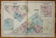
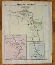
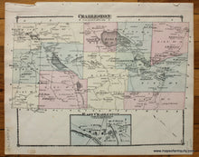
Antique hand colored double sheet of Morgan and Salem, Vermont maps with inset maps of Morgan Center and a section of Morgan, VT. Verso: A map of Charleston, VT with an inset map of East Charleston and A map of West Charleston with inset maps of Evansville and East Albany, VT. By Beers, from the "Atlas of the Counties of Lamoille and Orleans, Vermont," 1878. Shows the names of property owners at that time. Good condition with overall toning of the antique paper, some spots of foxing, and mild seam separation. Double sheet map measures approximately 13.75" x 22" to the neatline. Single page map of Charleston/East Charleston measures approx. 10.5" x 13.75" to the neatline. Single page map of West Charleston/Evansville/East Albany measures approximately 13.75" x 10.5" to the neatline.

Item Number: VER199