1908
Maker: Rand-McNally
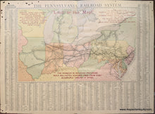
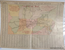
Antique printed color map of the Pennsylvania Railroad System from the Rand-McNally Indexed Atlas, 1908. Captions in red read: "Look at the Map!" "Principal Trunk Lines through Western Gateways, to the Atlantic Seaboard, with Subsidiary Lines reaching into Fourteen States, and Extending over Eleven Thousand Miles of the Most Active Industrial Section of the United States." "The Capital Route East, Reaching the Capital Cities of Four States and the National Capital Crossing the Largest Rivers from the Mississippi to the Hudson, the Natural Short Line over the Allegheny Mountains, Most Direct Route between East and West." "The Pioneer in Railroad Progress, Rock Ballasted Roadbed Free from Dust, Quadruple Tracks of Steel." Around the sides and bottom of the map are all of the stations on the map. Good antique condition with some small holes and stains at the edges of the paper. Map measures approx. 13.5 x 22 inches to the border and total sheet measures approx. 20.5 x 28 inches.
Item Number: MWE505


