Current hours: 10am to 5pm Monday through Saturday. Closed on Sundays. PLEASE NOTE: Our maps are only available at our website www.mapsofantiquity.com or at our store!

Genuine-Antique-Nautical-Chart-Untitled-Long-Island-1860-Charles-Copley-Maps-Of-Antiquity
  • Load image into Gallery viewer, Genuine-Antique-Nautical-Chart-Untitled-Long-Island-1860-Charles-Copley-Maps-Of-Antiquity
  • Load image into Gallery viewer, Genuine-Antique-Nautical-Chart-Untitled-Long-Island-1860-Charles-Copley-Maps-Of-Antiquity
  • Load image into Gallery viewer, Genuine-Antique-Nautical-Chart-Untitled-Long-Island-1860-Charles-Copley-Maps-Of-Antiquity
  • Load image into Gallery viewer, Genuine-Antique-Nautical-Chart-Untitled-Long-Island-1860-Charles-Copley-Maps-Of-Antiquity
  • Load image into Gallery viewer, Genuine-Antique-Nautical-Chart-Untitled-Long-Island-1860-Charles-Copley-Maps-Of-Antiquity
  • Load image into Gallery viewer, Genuine-Antique-Nautical-Chart-Untitled-Long-Island-1860-Charles-Copley-Maps-Of-Antiquity

1860 - [Untitled] Long Island - Antique Chart

Regular price
$2,500.00
Sale price
$2,500.00
Regular price
Sold out
Unit price
per 
Shipping calculated at checkout.

Item number: NAU402
Genuine Antique Nautical Chart

1860

Maker: Charles Copley

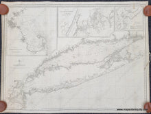
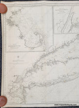
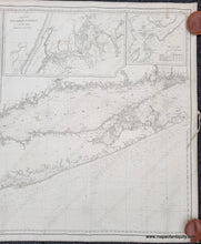
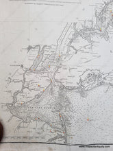
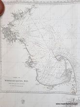
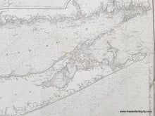
Rare antique chart of Long Island drawn and published by Charles Copley, 1860. This handsome chart features all of Long Island and Long Island Sound, with the coast of Connecticut, as well as Manhatten, Staten Island, Jersey City, and Sandy Hook. Inset maps of Massachusetts Bay, which includes Boston and part of Cape Cod and Cape Ann, the East River Entrance to New York which shows Manhattan with the yet-to-be-completed Central Park, and Hell Gate. Includes lighthouses and water depths. This fine blueback chart is in very good antique condition with minor signs of age, including mild stains. It is bound on all edges and includes a tie on one side.

Item Number: NAU402