Current hours: 10am to 5pm Monday through Saturday. 12pm to 5pm Sundays. IMPORTANT PLEASE NOTE: We have become aware that some of our photos have been stolen by other websites. Our maps are only available at our website www.mapsofantiquity.com or at our store!

Genuine-Antique-Nautical-Chart-A-New-Chart-of-the-South-Pacific-Ocean-including-Australia-the-East-India-Islands-Polynesia-the-Western-Coast-of-South-America-1849-1855-Imray-Maps-Of-Antiquity
  • Load image into Gallery viewer, Genuine-Antique-Nautical-Chart-A-New-Chart-of-the-South-Pacific-Ocean-including-Australia-the-East-India-Islands-Polynesia-the-Western-Coast-of-South-America-1849-1855-Imray-Maps-Of-Antiquity
  • Load image into Gallery viewer, Genuine-Antique-Nautical-Chart-A-New-Chart-of-the-South-Pacific-Ocean-including-Australia-the-East-India-Islands-Polynesia-the-Western-Coast-of-South-America-1849-1855-Imray-Maps-Of-Antiquity
  • Load image into Gallery viewer, Genuine-Antique-Nautical-Chart-A-New-Chart-of-the-South-Pacific-Ocean-including-Australia-the-East-India-Islands-Polynesia-the-Western-Coast-of-South-America-1849-1855-Imray-Maps-Of-Antiquity
  • Load image into Gallery viewer, Genuine-Antique-Nautical-Chart-A-New-Chart-of-the-South-Pacific-Ocean-including-Australia-the-East-India-Islands-Polynesia-the-Western-Coast-of-South-America-1849-1855-Imray-Maps-Of-Antiquity
  • Load image into Gallery viewer, Genuine-Antique-Nautical-Chart-A-New-Chart-of-the-South-Pacific-Ocean-including-Australia-the-East-India-Islands-Polynesia-the-Western-Coast-of-South-America-1849-1855-Imray-Maps-Of-Antiquity
  • Load image into Gallery viewer, Genuine-Antique-Nautical-Chart-A-New-Chart-of-the-South-Pacific-Ocean-including-Australia-the-East-India-Islands-Polynesia-the-Western-Coast-of-South-America-1849-1855-Imray-Maps-Of-Antiquity
  • Load image into Gallery viewer, Genuine-Antique-Nautical-Chart-A-New-Chart-of-the-South-Pacific-Ocean-including-Australia-the-East-India-Islands-Polynesia-the-Western-Coast-of-South-America-1849-1855-Imray-Maps-Of-Antiquity
  • Load image into Gallery viewer, Genuine-Antique-Nautical-Chart-A-New-Chart-of-the-South-Pacific-Ocean-including-Australia-the-East-India-Islands-Polynesia-the-Western-Coast-of-South-America-1849-1855-Imray-Maps-Of-Antiquity
  • Load image into Gallery viewer, Genuine-Antique-Nautical-Chart-A-New-Chart-of-the-South-Pacific-Ocean-including-Australia-the-East-India-Islands-Polynesia-the-Western-Coast-of-South-America-1849-1855-Imray-Maps-Of-Antiquity
  • Load image into Gallery viewer, Genuine-Antique-Nautical-Chart-A-New-Chart-of-the-South-Pacific-Ocean-including-Australia-the-East-India-Islands-Polynesia-the-Western-Coast-of-South-America-1849-1855-Imray-Maps-Of-Antiquity
  • Load image into Gallery viewer, Genuine-Antique-Nautical-Chart-A-New-Chart-of-the-South-Pacific-Ocean-including-Australia-the-East-India-Islands-Polynesia-the-Western-Coast-of-South-America-1849-1855-Imray-Maps-Of-Antiquity
  • Load image into Gallery viewer, Genuine-Antique-Nautical-Chart-A-New-Chart-of-the-South-Pacific-Ocean-including-Australia-the-East-India-Islands-Polynesia-the-Western-Coast-of-South-America-1849-1855-Imray-Maps-Of-Antiquity

1849/1855 - A New Chart of the South Pacific Ocean including Australia, the East India Islands, Polynesia & the Western Coast of South America - Antique Map

Regular price
$1,200.00
Sale price
$1,200.00
Regular price
Sold out
Unit price
per 
Shipping calculated at checkout.

Item number: NAU450
Genuine Antique Nautical Chart

1849/1855

Maker: Imray

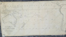
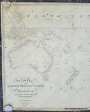
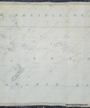
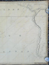
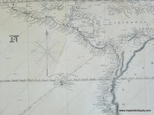
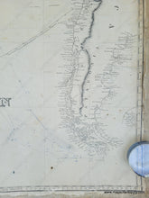
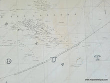
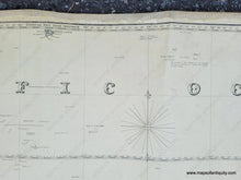
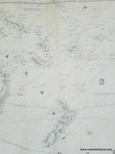
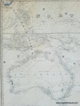
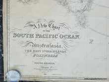
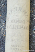
Antique nautical chart of the South Pacific published by James Imray & Son, 1849 with additions to 1855. This exquisite chart includes the Philippines, Polynesia, Australia, New Zealand, Easter Island, the Galapagos Islands, part of Hawaii, the west coast of South America including Patagonia, and part of the Caribbean. It features a gorgeous combination of fonts that are characteristic of the more valuable antique charts. This chart has some notations such as "Islands from the Spanish Charts (Doubtful)" and labels with "?" indicating there were still areas that were unknown. This chart is in fair to good antique condition. It has plotting from a navigator who used the chart aboard a ship. It has some wrinkles, stains, and damage consistent with being a used sailing chart. It is backed on fabric. The fabric is original to the chart and is made of several sections sewn together because a large single piece of fabric would have been expensive. Could be professionally restored for an additional cost. Measures approx. 37 x 73.5 inches to the neatline and 38.5 x 75 inches to the edges.

Item Number: NAU450