Genuine-Antique-Nautical-Chart-East-India-Archipelago-Western-Route-to-China-Chart-No-2--1886-James-Imray-&-Son--Maps-Of-Antiquity
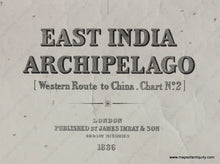
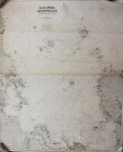
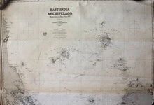
1886 - East India Archipelago (Western Route to China, Chart No. 2) - Antique Chart
  • Load image into Gallery viewer, Genuine-Antique-Nautical-Chart-East-India-Archipelago-Western-Route-to-China-Chart-No-2--1886-James-Imray-&-Son--Maps-Of-Antiquity
  • Load image into Gallery viewer, Genuine-Antique-Nautical-Chart-East-India-Archipelago-Western-Route-to-China-Chart-No-2--1886-James-Imray-&-Son--Maps-Of-Antiquity
  • Load image into Gallery viewer, 1886 - East India Archipelago (Western Route to China, Chart No. 2) - Antique Chart
  • Load image into Gallery viewer, 1886 - East India Archipelago (Western Route to China, Chart No. 2) - Antique Chart
  • Load image into Gallery viewer, 1886 - East India Archipelago (Western Route to China, Chart No. 2) - Antique Chart
  • Load image into Gallery viewer, 1886 - East India Archipelago (Western Route to China, Chart No. 2) - Antique Chart
  • Load image into Gallery viewer, 1886 - East India Archipelago (Western Route to China, Chart No. 2) - Antique Chart

1886 - East India Archipelago (Western Route to China, Chart No. 2) - Antique Chart

Regular price
$500.00
Sale price
$500.00
Regular price
Sold out
Unit price
per 
Shipping calculated at checkout.

Item number: NAU496
Genuine Antique Nautical Chart

1886

Maker: James Imray & Son

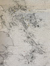
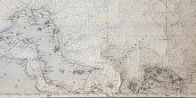
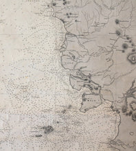
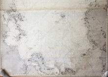
Black and white antique nautical chart, shows the area around The East India Archipelago including parts of Borneo, Malaysia, Sumatra, and the Anamba and Natuna Regency Islands with detailed bathymetric data near the Java and South China Seas. Good condition, center folds, foxing, wrinkles, plotting marks, approximately 48" x 40" to the neat lines

Item Number: NAU496