Current hours: 10am to 5pm Monday through Saturday and 12-5 on Sundays. CLOSED SUNDAY JUNE 8 and THURSDAY JUNE 12. Proud to be a SMALL, LOCAL, CAPE COD BUSINESS! Maps of Antiquity is in its 38th year! Our maps are only available at our website www.mapsofantiquity.com or at our store!

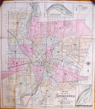
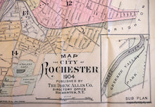
Antique-Hand-Colored-Map-New-Colored-Map-of-Rochester-United-States-New-York-1904-Drew-Allis-Co.-Maps-Of-Antiquity
1904 - New Colored Map Of Rochester Antique Genuine Hand-Colored
  • Load image into Gallery viewer, Antique-Hand-Colored-Map-New-Colored-Map-of-Rochester-United-States-New-York-1904-Drew-Allis-Co.-Maps-Of-Antiquity
  • Load image into Gallery viewer, 1904 - New Colored Map Of Rochester Antique Genuine Hand-Colored

1904 - New Colored Map of Rochester - Antique Map

Regular price
$125.00
Sale price
$125.00
Regular price
Sold out
Unit price
per 
Shipping calculated at checkout.

Item number: NYO529
Genuine Antique Hand Colored Map

1904

Maker: Drew Allis Co..

Hand Colored antique folding pocket map of Rochester, New York, at the turn of the century, with fine detail of streets, civic buildings, churches, cemeteries, and schools, with insets of both Seneca Park and Genesee Valley Park, located on opposite shores of the Genesee River and both designed by Frederick Law Olmsted. Published by The Drew Allis Co. Very good condition, with 1.5 inch tear along left margin, measures 24 by 21 inches unfolded, folds up into fabric-covered cardboard cover, 6.5 x 4 inches.

Item Number: NYO529