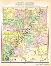
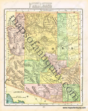
1900
Maker: Cram.
Antique printed color map of New Mexico (Recto.) This map takes an interesting shape, as it is not a perfect rectangle. Verso: A map of Arizona. Both maps include lists of counties and chief cities at the top. Very good condition with some very mild overall toning. By Cram, in Cram's Universal Atlas Geographical, Astronomical and Historical, 1900. Map of New Mexico measures approximately 12" x 10.25" (at its widest) to the neatline. Map of Arizona measures approx. 12" x 9.75" to the neatline. Note: Lists of counties and chief cities do not lie within the neatlines of these maps.
Item Number: WES207


