1892
Maker: Home Library & Supply Association.
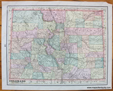
Antique printed color map of New Mexico (Recto.) On verso, a map of Colorado. Both maps are colored by county and include railroads, bodies of water, topographical detail, Indian Reservations, and names of major towns/cities. Published in "The Pacific Coast and the World" by the Home Library and Supply Association, 1892. Very good overall antique condition with some minor paper loss in one corner. Recto map (New Mexico) measures approximately 12" x 9.75" (H x W) to the neatline. Verso map (Colorado) measures approx. 10.25" x 13" to the neatline.
Item Number: WES299


