Current hours: 10am to 5pm Monday through Saturday. 12pm to 5pm Sundays. IMPORTANT PLEASE NOTE: We have become aware that some of our photos have been stolen by other websites. Our maps are only available at our website www.mapsofantiquity.com or at our store!

Antique-Hand-Colored-Map-New-York-City-Upper-Manhattan-Fort-Washington-Park-United-States-New-York-City-and-Brooklyn-1916-Bromley-Maps-Of-Antiquity
1916 - New York City Upper Manhattan Fort Washington Park - Antique Map
  • Load image into Gallery viewer, Antique-Hand-Colored-Map-New-York-City-Upper-Manhattan-Fort-Washington-Park-United-States-New-York-City-and-Brooklyn-1916-Bromley-Maps-Of-Antiquity
  • Load image into Gallery viewer, 1916 - New York City Upper Manhattan Fort Washington Park - Antique Map

1916 - New York City Upper Manhattan Fort Washington Park - Antique Map

Regular price
$125.00
Sale price
$125.00
Regular price
Sold out
Unit price
per 
Shipping calculated at checkout.

Item number: NYO564
Genuine Antique Hand Colored Map

1916

Maker: Bromley.

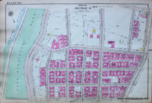
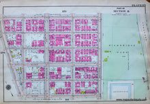
Antique hand colored map showing part of Manhattan, New York City, near Fort Washington Park and West 181st St. Includes from the Hudson river to Broadway with the Holyrood Church, Fort Washington Reformed Church, and many blocks that are now gone, where Rte. 95 is approaching the George Washington Bridge. Reverse side has another part of section 8, showing from Broadway east to the speedway and Highbridge Park and from West 178th St to West 173rd St. Very good antique condition with some small minor tears at edges in margins and some small tape repairs on back side. Approx. 11 x 16 inches

Item Number: NYO564