Current hours: 10am to 5pm Monday through Saturday. 12pm to 5pm Sundays. IMPORTANT PLEASE NOTE: We have become aware that some of our photos have been stolen by other websites. Our maps are only available at our website www.mapsofantiquity.com or at our store!

Antique-Printed-Color-Folding-Topographic-Map-New-York-Topographic-Map-showing-the-Adirondack-High-Peaks-c.1930s-USGS-Northeast-New-York-1900s-20th-century-Maps-of-Antiquity
C.1930S - New York Topographic Map Showing The Adirondack High Peaks Antique Genuine Printed-Color
  • Load image into Gallery viewer, Antique-Printed-Color-Folding-Topographic-Map-New-York-Topographic-Map-showing-the-Adirondack-High-Peaks-c.1930s-USGS-Northeast-New-York-1900s-20th-century-Maps-of-Antiquity
  • Load image into Gallery viewer, C.1930S - New York Topographic Map Showing The Adirondack High Peaks Antique Genuine Printed-Color
  • Load image into Gallery viewer, C.1930S - New York Topographic Map Showing The Adirondack High Peaks Antique Genuine Printed-Color

c.1930s - New York Topographic Map showing the Adirondack High Peaks - Antique Map

Regular price
$150.00
Sale price
$150.00
Regular price
Sold out
Unit price
per 
Shipping calculated at checkout.

Item number: NYO819
Genuine Antique Printed Color Folding Topographic Map

c.1930s

Maker: USGS.

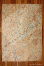
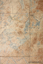
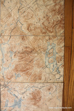
Untitled antique topographical map of New York showing the Adirondack High Peaks, published by the US Geological Survey, undated but probably 1930s. Includes Saranac Lake, Tupper Lake, Lake Placid, Long Lake, and much more. This is a folding map made of 18 sections attached to a linen back, which allows the map to fold easily for travel. Good antique condition with visible seams where maps were joined, and a 3 inch piece of tape at the center on the surface near Lake Clear (tape may or may not be archival). Approx. 39.25 x 27.25 inches to the edges.

Item Number: NYO819