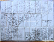
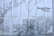
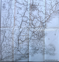
c. 1900
Maker: Boston & Maine Railroad
Antique railroad map of New England, includes Long Island, Massachusetts, Rhode Island, Connecticut, Vermont, New Hampshire, Maine and parts of Canada, Quebec, Nova Scotia, New Brunswick, Prince Edward Island, Bay of Fundy and Gulf of St. Lawrence. With insets of St Andrews and N.B. "About There", the White Mountain Region, and Mount Desert Island and Vicinity. Published by the Boston & Maine Railroad c. 1900. Good to very good condition, with folds as issued and some small separations at the fold intersections, and very slight foxing and toning (barely visible). Measures approx. 22.75 x 30.75 inches to the border line.
Item Number: NEW187


