Winter hours: Tuesday - Saturday 10am to 5pm. Close Sundays and Mondays until May. We appreciate your business!

Genuine-Antique-Book-with-Map-Tourist-Map-of-the-Boston-and-Maine-Railroad-1890-Boston-&-Maine-Railroad-Maps-Of-Antiquity
  • Load image into Gallery viewer, Genuine-Antique-Book-with-Map-Tourist-Map-of-the-Boston-and-Maine-Railroad-1890-Boston-&-Maine-Railroad-Maps-Of-Antiquity
  • Load image into Gallery viewer, Genuine-Antique-Book-with-Map-Tourist-Map-of-the-Boston-and-Maine-Railroad-1890-Boston-&-Maine-Railroad-Maps-Of-Antiquity
  • Load image into Gallery viewer, Genuine-Antique-Book-with-Map-Tourist-Map-of-the-Boston-and-Maine-Railroad-1890-Boston-&-Maine-Railroad-Maps-Of-Antiquity
  • Load image into Gallery viewer, Genuine-Antique-Book-with-Map-Tourist-Map-of-the-Boston-and-Maine-Railroad-1890-Boston-&-Maine-Railroad-Maps-Of-Antiquity

1890 - Tourist Map of the Boston and Maine Railroad - Antique Map

Regular price
$115.00
Sale price
$115.00
Regular price
Sold out
Unit price
per 
Shipping calculated at checkout.

Item number: NEW196
Genuine Antique Book with Map

1890

Maker: Boston & Maine Railroad

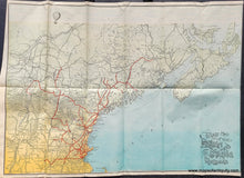
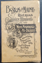
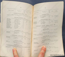
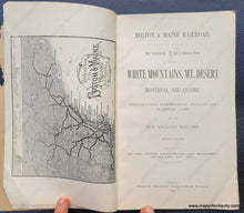
Antique tourism booklet with map, published by the Boston & Maine Railroad, 1890. Booklet title "Boston and Maine Railroad Summer Excursions to the White Mountains, Mt. Desert, Winnipesaukee, Rangeley and Mooshead Lakes, and the New England Beaches- Routes, Rates, Maps, Hotel & Boarding House List, Etc. Etc." This vibrant map of New England shows the route of the Boston and Maine Railroad, covering Massachusetts, Vermont, New Hampshire, and Maine with stops in many popular tourism destinations. Delightful details include the vintage typography of the title, a false horizon at the top of the map with a blue summer sky streaked with light clouds, and a hot air balloon dancing on the left side. Map is separated from the book. One other black and white map is in the booklet. Very good antique condition with folds as issued and very minor wear along the folds. Tight margin on right side. Booklet measures approx. 8 x 5 inches. Map measures approx. 14.5 x 20.5 inches to the neatline.

Item Number: NEW196