Current hours: 10am to 5pm Monday through Saturday. Closed on Sundays. IMPORTANT PLEASE NOTE: We have become aware that some of our photos have been stolen by other websites. Our maps are only available at our website www.mapsofantiquity.com or at our store!

1898 - The Hudson by Daylight Map from New York Bay to the Head of Tide Water ... also the Names of Prominent Residences, Historic Landmarks, the Old Reaches of the Hudson and Old Indian Names - Antique Map
Genuine-Antique-Printed-Color-Folding-Map-in-Book-The-Hudson-by-Daylight-Map-from-New-York-Bay-to-the-Head-of-Tide-Water-containing-Names-of-Streams-Islands-and-Heights-of-Mountains-According-to-the-latest-Coast-Survey-also-the-Names-of-Prominent-Residences-Historic-Landmarks-the-Old-Reaches-of-the-Hudson-and-Old-Indian-Names-1902-Wallace-Bruce-/-Bryant-Union-Maps-Of-Antiquity
1898 - The Hudson by Daylight Map from New York Bay to the Head of Tide Water ... also the Names of Prominent Residences, Historic Landmarks, the Old Reaches of the Hudson and Old Indian Names - Antique Map
  • Load image into Gallery viewer, 1898 - The Hudson by Daylight Map from New York Bay to the Head of Tide Water ... also the Names of Prominent Residences, Historic Landmarks, the Old Reaches of the Hudson and Old Indian Names - Antique Map
  • Load image into Gallery viewer, 1898 - The Hudson by Daylight Map from New York Bay to the Head of Tide Water ... also the Names of Prominent Residences, Historic Landmarks, the Old Reaches of the Hudson and Old Indian Names - Antique Map
  • Load image into Gallery viewer, Genuine-Antique-Printed-Color-Folding-Map-in-Book-The-Hudson-by-Daylight-Map-from-New-York-Bay-to-the-Head-of-Tide-Water-containing-Names-of-Streams-Islands-and-Heights-of-Mountains-According-to-the-latest-Coast-Survey-also-the-Names-of-Prominent-Residences-Historic-Landmarks-the-Old-Reaches-of-the-Hudson-and-Old-Indian-Names-1902-Wallace-Bruce-/-Bryant-Union-Maps-Of-Antiquity
  • Load image into Gallery viewer, 1898 - The Hudson by Daylight Map from New York Bay to the Head of Tide Water ... also the Names of Prominent Residences, Historic Landmarks, the Old Reaches of the Hudson and Old Indian Names - Antique Map
  • Load image into Gallery viewer, 1898 - The Hudson by Daylight Map from New York Bay to the Head of Tide Water ... also the Names of Prominent Residences, Historic Landmarks, the Old Reaches of the Hudson and Old Indian Names - Antique Map
  • Load image into Gallery viewer, 1898 - The Hudson by Daylight Map from New York Bay to the Head of Tide Water ... also the Names of Prominent Residences, Historic Landmarks, the Old Reaches of the Hudson and Old Indian Names - Antique Map
  • Load image into Gallery viewer, 1898 - The Hudson by Daylight Map from New York Bay to the Head of Tide Water ... also the Names of Prominent Residences, Historic Landmarks, the Old Reaches of the Hudson and Old Indian Names - Antique Map
  • Load image into Gallery viewer, 1898 - The Hudson by Daylight Map from New York Bay to the Head of Tide Water ... also the Names of Prominent Residences, Historic Landmarks, the Old Reaches of the Hudson and Old Indian Names - Antique Map
  • Load image into Gallery viewer, 1898 - The Hudson by Daylight Map from New York Bay to the Head of Tide Water ... also the Names of Prominent Residences, Historic Landmarks, the Old Reaches of the Hudson and Old Indian Names - Antique Map
  • Load image into Gallery viewer, 1898 - The Hudson by Daylight Map from New York Bay to the Head of Tide Water ... also the Names of Prominent Residences, Historic Landmarks, the Old Reaches of the Hudson and Old Indian Names - Antique Map

1898 - The Hudson by Daylight Map from New York Bay to the Head of Tide Water ... also the Names of Prominent Residences, Historic Landmarks, the Old Reaches of the Hudson and Old Indian Names - Antique Map

Regular price
$325.00
Sale price
$325.00
Regular price
Sold out
Unit price
per 
Shipping calculated at checkout.

Item number: NYO1024

Genuine Antique Printed Color Folding Map in Book

1898

Maker: Wallace Bruce / Bryant Literary Union


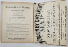
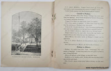
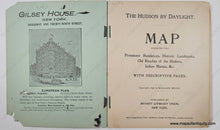
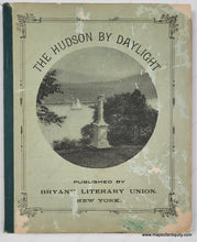
Antique map of the Hudson River, New York, by Wallace Bruce, published by Bryant Literary Union, copyright 1894 and included in the book The Hudson by Daylight published in 1898. This fantastic book takes you on a guided tour of early 20th century Hudson River, from New York City to Albany with reproduced photographs along the way, showing notable scenes, such as the Statue of Liberty, the home of Washington Irving, "Old Cro' Nest and Storm King" and many more. The map, as the title explains, includes towns, cities, public spaces, property owners' names, historic locations, etc. Map is folded as issued and attached at the back of the book. Map could be removed for framing however the very top section just above the title would be lost. Very good antique condition. The book is in fair to poor condition with loose pages, damaged cover, toning of the pages. Map is in very good condition with only some imperfections/separation at the joins: The map, being very long, is composed of multiple joined sheets. It could be sectioned for framing. Back cover is lost. Book measures approx. 6.25 x 5 inches and map measures approx. 102 inches tall by 5.5 inches wide.


Item Number: NYO1024