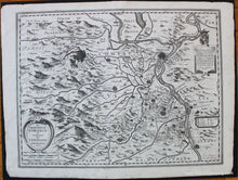
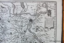
c. 1627
Maker: Hondius.
Antique uncolored map of part of France by Hondius, c. 1627. This map shows cities, towns, roads, rivers, forests, mountains, and more. Includes the Rhone River, Avignon, Carpentras, and the surrounding area. This map is oriented with north at the bottom of the map. Very good restored condition - map has been cleaned and deacidified and some tears have been repaired. Tears and wrinkles are still visible but minor. Measures approx. 14.75 x 19.5 inches to the neatline.
Item Number: EUR2701


