Winter hours: Tuesday - Saturday 10am to 5pm. Close Sundays and Mondays until May. We appreciate your business!

Antique-Nautical-Chart-Orkney-&-Feroe-Islands-to-the-Bay-of-Biscay-Europe--1879-Wilson-Maps-Of-Antiquity
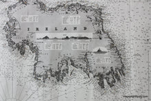
1879 - Great Britain and Ireland with coasts of France and Spain- Orkney & Faroe Islands to the Bay of Biscay - Antique Chart
  • Load image into Gallery viewer, Antique-Nautical-Chart-Orkney-&-Feroe-Islands-to-the-Bay-of-Biscay-Europe--1879-Wilson-Maps-Of-Antiquity
  • Load image into Gallery viewer, 1879 - Great Britain and Ireland with coasts of France and Spain- Orkney & Faroe Islands to the Bay of Biscay - Antique Chart
  • Load image into Gallery viewer, 1879 - Great Britain and Ireland with coasts of France and Spain- Orkney & Faroe Islands to the Bay of Biscay - Antique Chart
  • Load image into Gallery viewer, 1879 - Great Britain and Ireland with coasts of France and Spain- Orkney & Faroe Islands to the Bay of Biscay - Antique Chart
  • Load image into Gallery viewer, 1879 - Great Britain and Ireland with coasts of France and Spain- Orkney & Faroe Islands to the Bay of Biscay - Antique Chart

1879 - Great Britain and Ireland with coasts of France and Spain- Orkney & Faroe Islands to the Bay of Biscay - Antique Chart

Regular price
$2,500.00
Sale price
$2,500.00
Regular price
Sold out
Unit price
per 
Shipping calculated at checkout.

Item number: NAU155
Genuine Antique Nautical Chart

1879

Maker: Wilson.


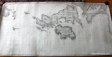
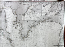
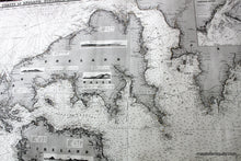
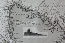
Famous blueback nautical chart with north oriented to the left, made of 3 joined charts. Includes 4 inset maps: Pentland Frith, etc, Scotland, Rockall, North of Ireland, Gironde River, France, Bilbao, Spain, 4 recognition profiles, 2 lighthouses. Lighthouses shown in red with circles showing light distance. Comprises the United Kingdom, UK and Ireland, English Channel, Atlantic Coast of France and Bay of Biscay Coast of Spain down to Cape Finisterre. Published by Wilson, late J.W. Norie and Wilson. Clean, excellent strike, and very good overall antique condition, Measures approx. 38 1/2 x 81" to the nealine. **NOTE- because this map requires extra insurance for shipping, an additional charge will appear on your card after your original purchase. If you would like to know what that charge will be, please contact us.**


Item Number: NAU155