Current hours: 10am to 5pm Monday through Saturday. Closed on Sundays. IMPORTANT PLEASE NOTE: We have become aware that some of our photos have been stolen by other websites. Our maps are only available at our website www.mapsofantiquity.com or at our store!

Genuine-Antique-Cane-with-Map-Antique-Map-in-a-Cane-Boston-1940-In-A-Cane-American-Legion-Maps-Of-Antiquity
  • Load image into Gallery viewer, Genuine-Antique-Cane-with-Map-Antique-Map-in-a-Cane-Boston-1940-In-A-Cane-American-Legion-Maps-Of-Antiquity
  • Load image into Gallery viewer, Genuine-Antique-Cane-with-Map-Antique-Map-in-a-Cane-Boston-1940-In-A-Cane-American-Legion-Maps-Of-Antiquity
  • Load image into Gallery viewer, Genuine-Antique-Cane-with-Map-Antique-Map-in-a-Cane-Boston-1940-In-A-Cane-American-Legion-Maps-Of-Antiquity
  • Load image into Gallery viewer, Genuine-Antique-Cane-with-Map-Antique-Map-in-a-Cane-Boston-1940-In-A-Cane-American-Legion-Maps-Of-Antiquity
  • Load image into Gallery viewer, Genuine-Antique-Cane-with-Map-Antique-Map-in-a-Cane-Boston-1940-In-A-Cane-American-Legion-Maps-Of-Antiquity

1940 - Antique Map-in-a-Cane Boston - Antique

Regular price
$495.00
Sale price
$495.00
Regular price
Sold out
Unit price
per 
Shipping calculated at checkout.

Item number: OTH385
Genuine Antique Cane with Map

1940

Maker: In-A-Cane


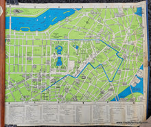
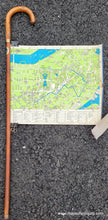
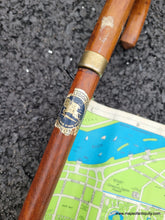
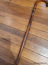
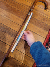
Antique wooden cane with a hidden roll-out map of Boston, made for the American Legion Convention in 1940. The map was possibly drawn by Richard F. Lufkin and his name may be in the left side corner of the map, where his maps typically say "Richard F. Lufkin - General Draftsman - Boston" (in our photo you can see the word Boston). The map within the cane is spring-loaded, and due to age, pulling the map out is a bit difficult. We were able to pull the map out to the extent shown in the photo but there is a bit more of the map still in the cane in our photo. The map shows the route of the American Legion Parade, as well as the Boston Common and Public Garden, illustrations of notable buildings and attractions, the railroad stations, Charles River, and more, with a key at bottom. Good to very good antique condition, with some wear to the cane surface including the American Legion sticker on front. The map has a tear at the center where is attaches to the metal rod pull, and some minor stains and wear to the map. Map and cane are each sturdy, and map has been pulled out several times without issue. Map measures approx. 13.5 x 17 inches (length is estimated as we were not able to pull the map out fully).


Item Number: OTH385