Current hours: 10:30am to 5pm Tuesday through Saturday. We are closed Sundays and Mondays for the Winter. IMPORTANT PLEASE NOTE: We have become aware that some of our photos have been stolen by other websites. Our maps are only available at our website www.mapsofantiquity.com or at our store!

Genuine-Antique-Travel-Booklet-The-Thousand-Islands-and-the-River-St-Lawrence-1910-Jame-Bayne-Company-Maps-Of-Antiquity
1910 - The Thousand Islands And The River St. Lawrence Antique Booklet With Map Genuine Travel
  • Load image into Gallery viewer, Genuine-Antique-Travel-Booklet-The-Thousand-Islands-and-the-River-St-Lawrence-1910-Jame-Bayne-Company-Maps-Of-Antiquity
  • Load image into Gallery viewer, 1910 - The Thousand Islands And The River St. Lawrence Antique Booklet With Map Genuine Travel
  • Load image into Gallery viewer, 1910 - The Thousand Islands And The River St. Lawrence Antique Booklet With Map Genuine Travel
  • Load image into Gallery viewer, 1910 - The Thousand Islands And The River St. Lawrence Antique Booklet With Map Genuine Travel
  • Load image into Gallery viewer, 1910 - The Thousand Islands And The River St. Lawrence Antique Booklet With Map Genuine Travel

1910 - The Thousand Islands and the River St. Lawrence - Antique Booklet with Map

Regular price
$115.00
Sale price
$115.00
Regular price
Sold out
Unit price
per 
Shipping calculated at checkout.

Item number: OTH412
Genuine Antique Travel Booklet

1910

Maker: James Bayne Company


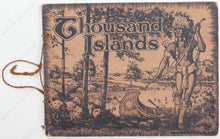
Antique travel booklet of the Thousand Islands and St Lawrence River, published by James Bayne Company, c. 1910. Stretching from Lake Ontario north along the St. Lawrence River to Lake Champlain, the Thousand Islands region between New York and Canada is a stunning mixture of woodlands, islands and water, and known for some of the best boating and fishing in the world. Includes a map at front and the booklet comprises dozens of photographs with captions. Some of the photographs have a note such as "Map Letter C" which indicates approximately where on the map is shown in the image. A few of the photographs are colorized but most are black and white. The photographs show the Thousand Island region as it was, its summer homes and hotels, and the steamboats and other pleasure craft on the river, including Montreal's "New Victoria Jubilee Bridge, constructed in 1899" and "The New Frontenac Hotel and Annex, Round Island," the crown jewel of the Thousand Islands, remodeled and enlarged in 1898 and destroyed by fire on 24 August 1911.This booklet includes a beautifully handwritten inscription. Unfortunately the ink of the inscription has slightly bled through to the upper right corner of the map. Overall good to very good condition. The map shows signs of age including wear at the folds and some small tears. The Booklet has wear at the edges. The fold-out map measures approx. 5.5 x 20.75 inches to the neatline. Booklet measures approx. 7 x 9 inches.


Item Number: OTH412