1900
Maker: Cram.
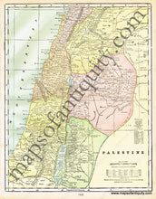
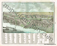
Antique printed color map of Palestine (Recto). Includes the area and population, as well as a list of chief cities. Also includes an explanation of words of frequent occurrence (e.g. Nahr means River, Tell means Hill, etc.) Verso: A Birds-Eye-View map of The Holy Land. Indicates towns, cities, rivers, and mountains in a reference at the bottom of the map. Very good condition with some slight toning at the edges of the page. By Cram, in Cram's Universal Atlas Geographical, Astronomical and Historical, 1900. Recto map measures approximately 13.5" x 10.5" to the neatline. Verso map measures approx.
Item Number: MID132


