Genuine Antique Map
1948
Maker: Cuban Tourism Commission.
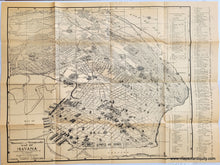
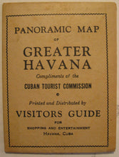
Antique black and white pictorial folding map of Havana, Cuba, drawn by Rogelio L. Mirabal, and produced by the Cuban Tourist Commission in 1948. Street names are listed, and the key at the right identifies 148 buildings. Some of the buildings are depicted with illustrations. Very good antique condition with overall toning, some areas of minor image overlay/ink transfer, and a few spots of very minor foxing/soiling, as well as some areas of seam separation. This map was printed on a newsprint type of paper, so it is somewhat fragile. Map measures approximately 16.75" x 20.25" to the neatline, with the page measuring approx. 17.75" x 24" overall, when unfolded. Measures approx. 6.25" x 4.5", when folded.
Genuine Vintage Map from 1948
Item Number: CAM129


