Genuine Antique Hand Colored Map
1873
Maker: Beers.
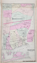
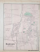
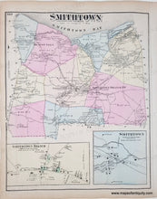
Antique double-sided map from the Atlas of Long Island, New York, by Beers, Comstock, & Cline, 1873. Centerfold map is Part of Huntington, with Babylon, Commac (Commack), Amityville, Melville, Half Way Hollow Hills, Plains, Great South Bay and Gilgo Inlet, Oak Island Beach and Cedar Island. Verso maps are Babylon center on one side and Smithtown on the other side. These maps show roads, railroads, parks, cemeteries, property owners, etc. Original hand-coloring. Good antique condition, some toning and foxing, minor stains. Centerfold map measures approx. 24.5 x 14 inches and verso maps approx. 10 x 13.5 inches to the neatline.
Genuine Antique Map from 1873.
Item Number: NYO041


