1917
Maker: Richards.
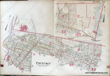
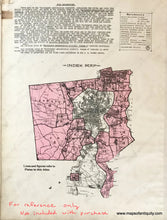
Antique map of part of Pawtucket, RI, Rhode Island, from Richards Standard Atlas of the "Providence Metropolitan District" volume 2, 1917. Includes the intersection of Ten Mile River with Seven Mile River, Broadway School, Sacred Heart of Jesus school, church, and convent, and many residences and manufacturing companies. These maps were created for tax and insurance purposes and the buildings are coloured by type- the color key was only included on the index, but yellow is wood, red (or pink) is brick, and brown is stone. Large numbers in red designate wards. Overall good antique condition with mild surface soiling at the paper edges, leather tab at left with tear, and a stain at right where the leather tab touches. Stain at upper left edge. Some tiny indents in the paper from the page being handled for over 100 years. Measures approx. 22 x 32 inches to the page edges.
Item Number: RHO203


