Current hours: 10am to 5pm Monday through Saturday. 12pm to 5pm Sundays. We are CLOSED on Christmas Day and New Years Day. We will close early (3pm) on Christmas Eve. IMPORTANT PLEASE NOTE: We have become aware that some of our photos have been stolen by other websites. Our maps are only available at our website www.mapsofantiquity.com or at our store!

1864 - Perrine's New Topographical War Map Of The Southern States. - Antique Map
1864 - Perrine’s New Topographical War Map Of The Southern States. Antique Genuine Folding
  • Load image into Gallery viewer, 1864 - Perrine's New Topographical War Map Of The Southern States. - Antique Map
  • Load image into Gallery viewer, 1864 - Perrine’s New Topographical War Map Of The Southern States. Antique Genuine Folding
  • Load image into Gallery viewer, 1864 - Perrine’s New Topographical War Map Of The Southern States. Antique Genuine Folding
  • Load image into Gallery viewer, 1864 - Perrine’s New Topographical War Map Of The Southern States. Antique Genuine Folding
  • Load image into Gallery viewer, 1864 - Perrine’s New Topographical War Map Of The Southern States. Antique Genuine Folding

1864 - Perrine's New Topographical War Map Of The Southern States. - Antique Map

Regular price
$450.00
Sale price
$450.00
Regular price
Sold out
Unit price
per 
Shipping calculated at checkout.

Item number: SOU477

BINGenuine Antique Folding Map and Booklet

1864

Maker: Charles O. Perrine

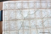
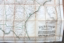
Antique folding map of the United States during the Civil War by Charles O. Perrine, 1864. Shows from Missouri south to Florida and east to the Atlantic Ocean. The southern part of Florida is included as an inset. Map has printed outline color by state and red circles to indicate battles and engagements. Includes cities, towns, railroads, and rivers. This map is attached to a cover and booklet "A Concise History of the War designs to accompany Perrine's New War Map... by Capt. John S. Bishop." Covers are tan/orange card board with "Perrine's New Topographical War Map Of The Southern States With A Chronology Of The Great Rebellion compiled from the Latest Government Surveys and Official Reports" with a black spine. Very good restored condition, has been cleaned, deacidified, and mounted on archival rice paper, then refolded. Some paper loss at folds and fold intersections (repaired but visible). Can be removed from the booklet for framing. Booklet measures approx. 6 x 4 inches and map measures approx. 28 x 37 inches.

Model Number: SOU477