1854
Maker: Black.
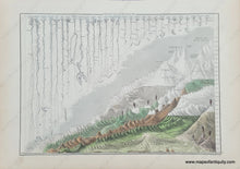
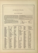
Antique comparative chart showing the heights of mountains and lengths of rivers, published by Black in 1854, Geo. Aikman Sculpt. The mountains are grouped by country and the rivers by lengths. Rivers are labeled, and the tallest mountains are labeled, and the key to the unlabeled mountains is included with this map. Interesting to note is the fact that the Missouri River is shown as the longest and it comprises part of the Mississippi River from its mouth. The Nile is now known as the longest river but at the time of the making of this map, it seems Lake Victoria had not been found by European mapmakers yet. Very good overall antique condition overall with minor toning of paper, and some mild spots/foxing. Measures approx. 10 x 14 1/2 inches to the neatline.
Item Number: COM017


