Winter hours: Tuesday - Saturday 10am to 5pm. Close Sundays and Mondays until May. We appreciate your business!

Antique-Map-Pictorial-Map-Glacier-National-Park-Waterton-Lakes-Great-Northern-Railway-Company-1939-1930s-Maps-of-Antiquity
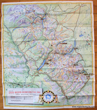
1939 - Pictorial Map of Glacier National Park, Waterton Lakes National Park - Antique Pictorial Map
  • Load image into Gallery viewer, Antique-Map-Pictorial-Map-Glacier-National-Park-Waterton-Lakes-Great-Northern-Railway-Company-1939-1930s-Maps-of-Antiquity
  • Load image into Gallery viewer, 1939 - Pictorial Map of Glacier National Park, Waterton Lakes National Park - Antique Pictorial Map

1939 - Pictorial Map of Glacier National Park, Waterton Lakes National Park - Antique Pictorial Map

Regular price
$175.00
Sale price
$175.00
Regular price
Sold out
Unit price
per 
Shipping calculated at checkout.

Item number: WES303
Genuine Antique Printed Color Pictorial Map

1939

Maker: Great Northern Railway Company.


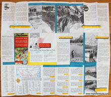
Antique printed color map of Glacier National Park in Montana and Waterton Lakes National Park in Canada, published by the Great Northern Railway Company, 1939. This map features lovely coloring, marked roads, trails, railways, labeled mountains and hotels. Verso features photographs of various pastimes that can be enjoyed in the area as well as travel information. As with many antique maps, some of the images and text may not be politically or culturally correct to modern standards. Very good condition with folds as issued. Approx. 30 x 26 inches to the paper edges.


Item Number: WES303