Current hours: 10:30am to 5pm Tuesday through Saturday. We are closed Sundays and Mondays for the Winter. IMPORTANT PLEASE NOTE: We have become aware that some of our photos have been stolen by other websites. Our maps are only available at our website www.mapsofantiquity.com or at our store!

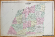
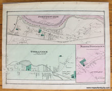
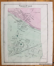
Antique-Hand-Colored-Map-Pittstown;-verso-maps:-Johnsonville-Tomhannock-North-Pittstown-Valley-Falls-NY-1876-Beers-1800s-19th-century-Maps-of-Antiquity
1876 - Pittstown; Verso Maps: Johnsonville Tomhannock North Pittstown Valley Falls Ny Antique Map
  • Load image into Gallery viewer, Antique-Hand-Colored-Map-Pittstown;-verso-maps:-Johnsonville-Tomhannock-North-Pittstown-Valley-Falls-NY-1876-Beers-1800s-19th-century-Maps-of-Antiquity
  • Load image into Gallery viewer, 1876 - Pittstown; Verso Maps: Johnsonville Tomhannock North Pittstown Valley Falls Ny Antique Map
  • Load image into Gallery viewer, 1876 - Pittstown; Verso Maps: Johnsonville Tomhannock North Pittstown Valley Falls Ny Antique Map

1876 - Pittstown; verso maps: Johnsonville, Tomhannock, North Pittstown, Valley Falls NY - Antique Map

Regular price
$95.00
Sale price
$95.00
Regular price
Sold out
Unit price
per 
Shipping calculated at checkout.

Item number: NYO836
Genuine Antique Hand Colored Map

1876

Maker: Beers.

Antique hand colored map of Pittstown, NY from Beers' Atlas of Rensselaer County, N.Y. by F.W. Beers & Co, 1876. Two versos: Johnsonville, Tomhannock, North Pittstown on one side and Valley Falls on the other. Includes streets, railroads, public buildings, parks, bodies of water, and property owners' names. Good condition with a few minor spots/stains. Pittstown map measures approx. 14.25 x 22 inches. Each verso side measures approx. 14 x 11 inches to the border line.

Item Number: NYO836