Genuine Antique Map
c. 1907
Maker: Dood, Mead & Co.
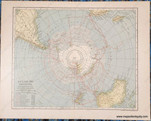
Antique printed color map of Antarctica, centered on the South Pole, which includes the routes of many explorations of the region between 1772-1904 and a key with the years and attributed name of each exploration. From the New International Encyclopedia, 1907. With fold, as issued. Very good overall antique condition with very mild toning of the paper, a few spots of very minor foxing, and some very minor edge wear. Map measures approximately 8.5" x 10.5" to the neatline.
Item Number: POL030


