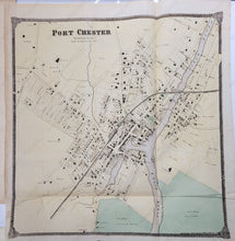
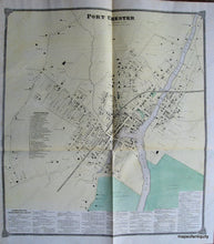
Genuine Antique Hand Colored Map
1867
Maker: Beers.
Antique hand colored map of Port Chester, NY, from the Atlas of New York and Vicinity, by Beers, 1867. Good to very good overall antique condition, with mild foxing. Folding map on parchment type paper. This map was published in two different sizes (all the atlases say 1867, although there were some changes made and the atlas was republished shortly later). The small size measures approx. 18.5 x 17.5 inches. The large size includes a Business Advertiser Directory at the bottom and measures approx. 23.75 x 21.25 inches to the outside of the decorative border.
Item Number: NYO170


