Printed-Color-Antique-Map-c.-1950-French-Ministry-of-Travel-Provence-Mediterranean-Sea-France-France
1950 - Provence, Mediterranean Sea, France - Antique Map
  • Load image into Gallery viewer, Printed-Color-Antique-Map-c.-1950-French-Ministry-of-Travel-Provence-Mediterranean-Sea-France-France
  • Load image into Gallery viewer, 1950 - Provence, Mediterranean Sea, France - Antique Map
  • Load image into Gallery viewer, 1950 - Provence, Mediterranean Sea, France - Antique Map
  • Load image into Gallery viewer, 1950 - Provence, Mediterranean Sea, France - Antique Map
  • Load image into Gallery viewer, 1950 - Provence, Mediterranean Sea, France - Antique Map

1950 - Provence, Mediterranean Sea, France - Antique Map

Regular price
$115.00
Sale price
$115.00
Regular price
Sold out
Unit price
per 
Shipping calculated at checkout.

Item number: EUR1540
Printed Color Genuine Antique Map

c. 1950

Maker: French Ministry of Travel.

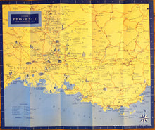
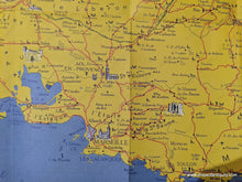
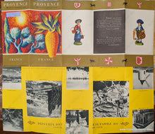
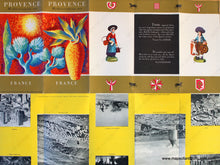
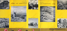
Antique printed color folding tourist map of the Mediterranean Sea of Provence in southern France, published by the French Ministry of Travel, lithography by Sofcar, in English, with major points of interest and a key to monuments, castles, cathedrals, ancient ruins, lighthouses, etc., verso features Scenes and Scenery or Provence Countryside and quotes by Van Gogh and Cezanne, c. 1950. Very good overall antique condition with vivid original color, some wear at the folds, and some slight smudges near the top of the paper. Measures approx. 20.5 x 17.5 inches unfolded.

Item Number: EUR1540