Antique-Hand-Colored-Map-Raymertown-Pittstown;-Melrose-Schaghticoke;-Grants-Hollow-Schaghticoke-and-Lansingburgh;-Verso:-Schaghticoke-Hill-Schaghticoke-and-Boyntonville-Pittstown-NY-1876-Beers-1800s-19th-century-Maps-of-Antiquity
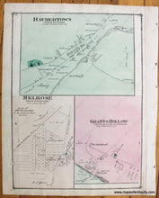
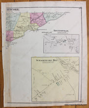
1876 - Raymertown, Pittstown; Melrose, Schaghticoke; Grants Hollow, Schaghticoke and Lansingburgh; Verso: Schaghticoke Hill, Schaghticoke and Boyntonville, Pittstown NY - Antique Map
  • Load image into Gallery viewer, Antique-Hand-Colored-Map-Raymertown-Pittstown;-Melrose-Schaghticoke;-Grants-Hollow-Schaghticoke-and-Lansingburgh;-Verso:-Schaghticoke-Hill-Schaghticoke-and-Boyntonville-Pittstown-NY-1876-Beers-1800s-19th-century-Maps-of-Antiquity
  • Load image into Gallery viewer, 1876 - Raymertown, Pittstown; Melrose, Schaghticoke; Grants Hollow, Schaghticoke and Lansingburgh; Verso: Schaghticoke Hill, Schaghticoke and Boyntonville, Pittstown NY - Antique Map

1876 - Raymertown, Pittstown; Melrose, Schaghticoke; Grants Hollow, Schaghticoke and Lansingburgh; Verso: Schaghticoke Hill, Schaghticoke and Boyntonville, Pittstown NY - Antique Map

Regular price
$50.00
Sale price
$50.00
Regular price
Sold out
Unit price
per 
Shipping calculated at checkout.

Item number: NYO835
Genuine Antique Hand Colored Map

1876

Maker: Beers.

Antique hand colored maps of Raymertown, Melrose, and Grants Hollow, NY from Beers' Atlas of Rensselaer County, N.Y. by F.W. Beers & Co, 1876. Verso: partial map with part of Schaghticoke at top left and two inset maps of parts of Schaghticoke and Pittstown. Includes streets, railroads, public buildings, parks, bodies of water, and property owners' names. Good condition with a few minor spots/stains. Recto map has binding paper on the right side near the border line. Verso map has a partial border. Each side measures approx. 14 x 11 inches to the border line.

Item Number: NYO835