Modern Print
Maker:
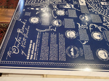
The Outer Banks of North Carolina, Graveyard of the Atlantic. Modern map showing major shipwrecks since 1600 around the Outer Banks, North Carolina NC. With names of the ships, dates of the wrecks, and lives lost (if known). Also features other illustrations, lighthouses, and historical information. Blueprint style in a navy color with white design. Nautical rope border. Measures approx. 29.5 x 23.5 inches to the page edges. Printed on poster paper with a semi-gloss surface.
Item Number: REP650


