1914 / 1938
Maker: George W. Rogers.
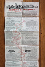
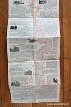
Antique printed color folding map of the James River by George W. Rogers, created and copyrighted 1914 and updated 1938. The intoduction to the map explains, "It is the object of this little brochure, in a very brief way, to point out to the reader, as he travels down America's most historic river, some of the famed localities and to refresh his memory with a few incidents of their history." Very good condition with toning, folds and issued, and some mis-folds. The map is attached to a jacket, the title on which is faded. Jacket can be folded back when framing the map. Measures approx. 37.5 x 10.75 inches overall.
Item Number: MAT273


