c. 1915
Maker: Walker.
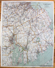
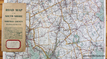
Antique printed color map of part of Massachusetts, including Plymouth County, Bristol County, and part of Norfolk County. The "Best Roads" are printed in red. By Walker, c. 1915. Towns include Abington, Hanover, Marshfield, Plympton, Bridgewater, Hanson, Mattapoisett, Rochester, Brockton, Hingham, Middleborough, Rockland, Carver, Hull, Norwell, Scituate, Duxbury, Kingston, Pembroke, Wareham, East Bridgewater, Lakeville, Plymouth, West Bridgewater, Halifax, Marion, Whitman, Acushnet, Berkley, Dartmouth, Dighton, Easton, Fairhaven, Freetown, Mansfield, North Attleborough, Norton, Raynham, Rehoboth, Seekonk, Somerset, Swansea, Westport, Avon, Bellingham, Brookline, Canton, Cohasset, Dedham, Dover, Foxborough, Holbrook, Medfield, Medway, Millis, Milton, Needham, Norfolk, Norwood, Plainville, Sharon, Stoughton, Walpole, Wellesley, Westwood, Wrentham, Boston, Boston Harbor, Newton, and more. Very good condition with folds as issued. Includes the paper cover, as seen in photos. Approx. 21.5 x 17 inches to the neatline.
Item Number: MAS1805


