Antique-Printed-Color-Pictorial-Map-Scenic-and-Historic-Illinois-1953-Brown-&-Burleigh-Midwest-Illinois-1900s-20th-century-Maps-of-Antiquity
1949 - Scenic and Historic Illinois - Antique Pictorial Map
  • Load image into Gallery viewer, Antique-Printed-Color-Pictorial-Map-Scenic-and-Historic-Illinois-1953-Brown-&-Burleigh-Midwest-Illinois-1900s-20th-century-Maps-of-Antiquity
  • Load image into Gallery viewer, 1949 - Scenic and Historic Illinois - Antique Pictorial Map

1949 - Scenic and Historic Illinois - Antique Pictorial Map

Regular price
$95.00
Sale price
$95.00
Regular price
Sold out
Unit price
per 
Shipping calculated at checkout.

Item number: MWE390
Genuine Antique Printed Color Pictorial Map

1949

Maker: Brown & Burleigh.


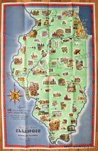
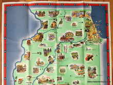
Colorful antique map of Illinois by E.H. Brown and R.A. Burleigh published in 1949. With bright original printed color and scattered illustrations showing "the dramatic, historic and legendary events, the great figures in Illinois history... [and] the scenic beauties that are found in all sections of the State." On the back of the map is a list of state parks and memorials with their location on the map, information about wildlife conservation, natural resources, and history. With folds as issued. Good condition with wear along the folds, some minor stains and small tears at paper edges. Printed on sturdy paper. Approx. 33 x 21 inches.


Item Number: MWE390