1903
Maker: U.S. Lighthouse Service.
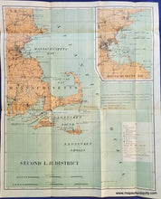
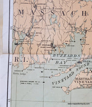
Antique folded map showing the lighthouse district from New Hampshire, Hampton Harbor to Rhode Island, Newport and Warwick, including Cape Cod, Plymouth, Boston, Nantucket and Martha's Vineyard. Inset map of Massachusetts Bay and Boston Harbor. Shows all light houses, light ships, fog signals, light buoys, etc. Fair to good overall condition with some repaired tears at the folds and small holes at the fold intersections. Measures approximately 19" x 15 3/4" to the neatline.
Item Number: MAS1323


