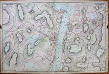
1891
Maker: Beers / Watson.
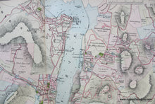
Antique hand colored map from the "Atlas of the Hudson River Valley from New York City to Troy Including a Section of about 8 Miles in Width" published in 1891 by Watson & Co. under the supervision of F.W. Beers. This map includes West Point, Garrison, Highland Falls, Cranstons, and more. Shows property owners, parks, major land and water features, etc. In very good to antique condition with mild toning, leather tab on right edge and stain from the tab on the left. Pencil marks where a previous owner made notes about local changes. It is backed on linen, with center fold as issued, measures approximately 30.5 x 20.5 inches.
Item Number: NYO914


