1874
Maker: Gray
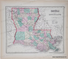
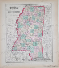
Antique hand colored map of Louisiana. On Verso is antique hand colored map of Mississippi. Published in Gray's Atlas, 1874. Both maps include a key and show railroads, common roads, canals, cities/towns, and village post offices, etc. at time of publication. Very good antique condition with mild toning of the paper, which is heavier at the outer edges, as well as minor foxing/soiling and edge wear with some small tears. Map of Louisiana measures approximately 11.75" x 14.75" to the neatline. Map of Mississippi measures approx. 14.75" x 11.75" to the neatline, with the map extending slightly past the neatline on the right side.
Genuine Antique Map from 1874
Item Number: SOU572


