c. 1905
Maker: Johnston
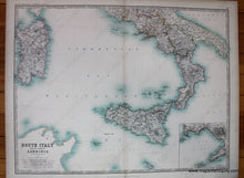
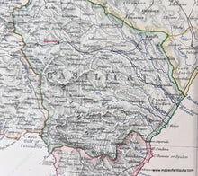
Antique printed color map of Southern Italy. Includes Sardinia and Sicily, as well as many of the smaller islands off Italy's coast (Lipari Islands, Ponza Islands, Malta, etc.) Also includes an inset map of the Bay of Naples featuring Pozzuoli Bay, the Island of Procida, the Island of Capri, Castellammare di Stabia, and Mount Vesuvius. Very good condition with some slight toning at the edges. By A. Keith Johnston, in The Royal Atlas of Modern Geography, c. 1905. Approximately 17.25" x 22.5"
Item Number: EUR1688


