Antique-Hand-Colored-Map-Switzerland-Philip-with-Comparative-Map-diagram-Comparative-Maps--1859-Philip-Maps-Of-Antiquity
1859 - Switzerland, Philip with Comparative Map diagram - Antique Map
  • Load image into Gallery viewer, Antique-Hand-Colored-Map-Switzerland-Philip-with-Comparative-Map-diagram-Comparative-Maps--1859-Philip-Maps-Of-Antiquity
  • Load image into Gallery viewer, 1859 - Switzerland, Philip with Comparative Map diagram - Antique Map

1859 - Switzerland, Philip with Comparative Map diagram - Antique Map

Regular price
$250.00
Sale price
$250.00
Regular price
Sold out
Unit price
per 
Shipping calculated at checkout.

Item number: COM020
Genuine Antique Hand Colored Map

1859

Maker: Philip.

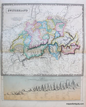
Hand colored map of Switzerland, colored by cantons, with mountains, lakes, cities, towns and railroad lines and stops. Diagram below the map includes comparative heights of principal mountains and passes of the Alps., very good condition overall with some foxing, both the map and diagram together measure 23" x 19".

Item Number: COM020