Current hours: 10am to 5pm Tuesday through Saturday. We are closed Sundays and Mondays until late May. Proud to be a SMALL, LOCAL, CAPE COD BUSINESS! Maps of Antiquity is in its 38th year! Our maps are only available at our website www.mapsofantiquity.com or at our store!

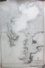
Black-and-White-Nautical-Chart-Tokyo-and-Gulf-of-Tokio-or-Yedo-Asia-Japan-1889-British-Admiralty-Maps-Of-Antiquity
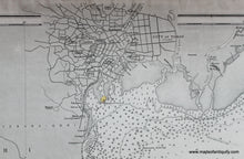
Close up on the city of tokyo with streets and the castle as it was in 1889. antique sailing nautical chart of tokyo bay Japan.
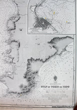
Close up on the inset of the city of Yokohama Japan as it was in 1889. antique sailing nautical chart of tokyo bay.
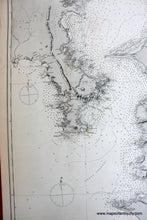
Close up on the area of Kamakura and yokosuka Japan as it was in 1889. antique sailing nautical chart of tokyo bay.
  • Load image into Gallery viewer, Black-and-White-Nautical-Chart-Tokyo-and-Gulf-of-Tokio-or-Yedo-Asia-Japan-1889-British-Admiralty-Maps-Of-Antiquity
  • Load image into Gallery viewer, Close up on the city of tokyo with streets and the castle as it was in 1889. antique sailing nautical chart of tokyo bay Japan.
  • Load image into Gallery viewer, Close up on the inset of the city of Yokohama Japan as it was in 1889. antique sailing nautical chart of tokyo bay.
  • Load image into Gallery viewer, Close up on the area of Kamakura and yokosuka Japan as it was in 1889. antique sailing nautical chart of tokyo bay.

1889 - Japan - Tokyo and Gulf of Tokio or Yedo - Antique Chart

Regular price
$925.00
Sale price
$925.00
Regular price
Sold out
Unit price
per 
Shipping calculated at checkout.

Item number: NAU214

Genuine Antique Nautical Chart

1889

Maker: British Admiralty.


Antique sailing chart of Tokyo Bay, Japan from 1889 by the British Admiralty. Shows the navigational information for the Gulf of Tokio or Yedo, which is now spelled Tokyo and a great depiction of the City of Tokyo with streets, notable buildings, and Japan's first railway. Although the railroad was opened in 1872, this chart shows it under construction, with a branch from Tokyo extending south and a branch from Yokohama extending north- they would eventually meet to create Japan's first railroad. Includes inset map of Yokohama Bay. All measurements are in fathoms. All bearings are magnetic. Very good antique condition with minor spotting and or staining. Some repaired tears barely visible from front. Slightly darker toning at bottom. Approx. 26 x 38.5 inches **NOTE- because this map requires extra insurance for shipping, an additional charge will appear on your card after your original purchase. If you would like to know what that charge will be, please contact us.**

Genuine Antique Sailing Chart from 1889

Item Number: NAU214