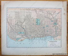
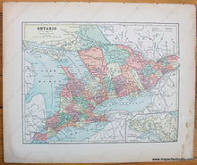
c. 1892
Maker: Hunt & Eaton.
Antique printed color map of the city of Toronto, showing a general overview of city blocks, names of major streets, railroads, steam and horse railways, points of interest (e.g. Lunatic Asylum, squares, parks, etc.,) as well as some topographical details (Recto.) On Verso: A map of a portion of present-day Ontario, Canada. Published by Hunt & Eaton, c. 1892. Good overall antique condition with mild toning throughout, as well as heavy water staining at the outer edges which does not affect the maps. Recto Map (Toronto) measures approximately 8.5" x 11.75" (H x W) to the neatline. Verso Map (Ontario) measures approx. 8.75" x 11.5" to the neatline. *Note: Priced As Is.
Item Number: CAN307


