Current hours: 10am to 5pm Monday through Saturday. Closed on Sundays. IMPORTANT PLEASE NOTE: We have become aware that some of our photos have been stolen by other websites. Our maps are only available at our website www.mapsofantiquity.com or at our store!

Genuine-Antique-Folding-Map-Map-of-Boston-and-the-Country-Adjacent,-showing-Rural-Parks-as-proposed-by-Ernest-W.-Bowditch-1875-A.-Williams-&-Co.-Maps-Of-Antiquity
  • Load image into Gallery viewer, Genuine-Antique-Folding-Map-Map-of-Boston-and-the-Country-Adjacent,-showing-Rural-Parks-as-proposed-by-Ernest-W.-Bowditch-1875-A.-Williams-&-Co.-Maps-Of-Antiquity
  • Load image into Gallery viewer, Genuine-Antique-Folding-Map-Map-of-Boston-and-the-Country-Adjacent,-showing-Rural-Parks-as-proposed-by-Ernest-W.-Bowditch-1875-A.-Williams-&-Co.-Maps-Of-Antiquity
  • Load image into Gallery viewer, Genuine-Antique-Folding-Map-Map-of-Boston-and-the-Country-Adjacent,-showing-Rural-Parks-as-proposed-by-Ernest-W.-Bowditch-1875-A.-Williams-&-Co.-Maps-Of-Antiquity

1875 - Map of Boston and the Country Adjacent, showing Rural Parks as proposed by Ernest W. Bowditch - Antique Map

Regular price
$325.00
Sale price
$325.00
Regular price
Sold out
Unit price
per 
Shipping calculated at checkout.

Item number: TOW669
Genuine Antique Folding Map

1875

Maker: A. Williams & Co.


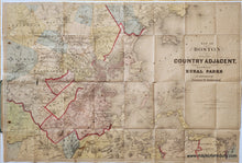
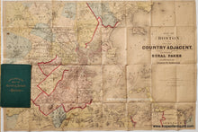
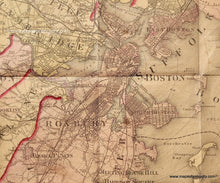
Antique hand-colored map of Boston and vicinity, published by A. Williams & Co., c. 1875. This map has a title that indicates that it shows proposed rural parks, however it seems that the version published by Williams & Co was adjusted and does not reflect the title. It could be that Williams purchased the printing plate for this map from Bowditch, creating a folding pocket map of the Boston area. An example of the version with the parks can be found on the NY Public Library's website. Bowditch was an architecture consultant, surveyor, and landscape gardener. He frequently worked with Frederick Law Olmsted, Sr. and John Charles Olmsted, often as a surveyor or draftsman. This map is colored by town with bright red lines indicating counties. It shows Boston in the middle of the filling of Back Bay fill. Large gaps with proposed roads dotted  overtop remain. A previous owner has written in delicate lines of red pen a route of some sort that takes a circuitous route from Chestnut Hill to Forest Hills. This map is in fair to good antique condition with some spots and stains, separations at the fold intersections that can be archivally repaired, and some damage where the corner of the booklet cover came through the map. With folds as issued. Attached to booklet cover, but may be able to be removed or have the cover folded back for framing. Measures approx. 17 x 25 inches to the neatline. This map could be restored (removed from the cover, cleaned, flattened, and backed) for around $150)


Item Number: TOW669