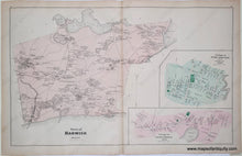
Genuine Antique Hand-Colored Map
1880
Maker: Walker.
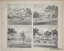
Antique hand-colored map of the Town of Harwich, the Village of West Harwich, and the Village of South Harwich, from Walker's 1880 Atlas of Barnstable County. Four engravings on reverse showing residences of J.H. Freeman, Wellfleet; H. L. Freeman, Provincetown; Jas. H Sears, Brewster; Isaac Crosby; East Brewster. These were likely prominent people who paid to have a print of their home in the atlas, thus financially supporting the creation of the atlas. Map measures approx. 16 x 26 inches to the neatline. Very good overall antique condition with minor stains, toning, slight wrinkling of the antique paper. Others may be available, condition and pricing may vary.
Item Number: MAS138


