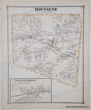
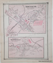
1875 - Townsend, with Townsend Harbor Inset (MA), Townsend center & East Part of West Townsend- Antique Map
Antique-Map-Townsend-&-East-Part-of-West-Townsend-Massachusetts-Maps-of-Antiquity
  • Load image into Gallery viewer, 1875 - Townsend, with Townsend Harbor Inset (MA), Townsend center & East Part of West Townsend- Antique Map
  • Load image into Gallery viewer, Antique-Map-Townsend-&-East-Part-of-West-Townsend-Massachusetts-Maps-of-Antiquity

1875 - Townsend, with Townsend Harbor Inset (MA), Townsend center & East Part of West Townsend- Antique Map

Regular price
$75.00
Sale price
$75.00
Regular price
Sold out
Unit price
per 
Shipping calculated at checkout.

Item number: MAS596

Genuine Antique Hand-Colored Map

1875

Maker: Beers.

Antique double-sided page of maps of Townsend, MA from the Middlesex County Atlas, Beers & Co., 1875. One side has the whole town of Townsend and the back side has Townsend village center & East Part of West Townsend. Measures approx. 14 x 11 inches. Very good overall antique condition with minor signs of age.


Item Number: MAS596