1892
Maker: Home Library & Supply Association.
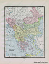
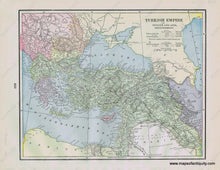
Antique printed color map of the Balkans- present-day Greece, Bulgaria, Serbia, Romania, Albania, Macedonia, etc. - (Recto) including topographical details, major cities/towns, etc. On Verso, a map of the Turkish Empire in Europe and Asia, including major cities/towns, topographical details, etc. Both maps include a table with area in square miles and population for the represented countries at the time of publication. Published in "The Pacific Coast and the World" by the Home Library and Supply Association, 1892. Very good overall antique condition with some mild toning/foxing, mainly at the outer edges. Recto map (Turkey in Europe, Greece, etc.) measures approximately 11.25" x 8.75" (H x W) to the neatline. Verso map (Turkish Empire) measures approx. 9.75" x 12" to the neatline.
Item Number: EUR2350


