1903
Maker: Cram
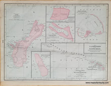
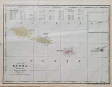
Antique printed color double-sided map published in Cram's 1903 atlas. One side of the sheet shows US possessions in the Pacific, including Guam, Howland Island, Baker Island, Wake Island, Midway Islands, and the Hawaiian or Sandwich Islands and Westward Islands of the North Pacific. On the other side is a map of Samoa during the short time that Germany owned Upolu, Savai'i 1900-1914. Very good antique condition with mild toning. The printed color is slightly offset. The maps measure approx. 10 x 13.5 inches to the neatline.
Item Number: USA416


