UNFRAMED MAPS should be ordered PRIOR TO Thursday, DECEMBER 19th for arrival by December 25th (December 13th deadline for Hawaii). We are PAST THE DEADLINE for orders with custom framing unless you will be picking up. Current hours: 10am to 5pm Monday through Saturday. 12pm to 5pm Sundays. IMPORTANT PLEASE NOTE: We have become aware that some of our photos have been stolen by other websites. Our maps are only available at our website www.mapsofantiquity.com or at our store!

Genuine-Antique-Wall-Map-Mitchells-New-National-Map-Exhibiting-the-United-States-with-the-North-American-British-Provinces-Sandwich-Islands-Mexico-and-Central-America-together-with-Cuba-and-other-West-India-Islands-1858-S-Augustus-Mitchell-Maps-Of-Antiquity
1858 - Mitchell’s New National Map Exhibiting The United States With North American British
  • Load image into Gallery viewer, Genuine-Antique-Wall-Map-Mitchells-New-National-Map-Exhibiting-the-United-States-with-the-North-American-British-Provinces-Sandwich-Islands-Mexico-and-Central-America-together-with-Cuba-and-other-West-India-Islands-1858-S-Augustus-Mitchell-Maps-Of-Antiquity
  • Load image into Gallery viewer, 1858 - Mitchell’s New National Map Exhibiting The United States With North American British
  • Load image into Gallery viewer, 1858 - Mitchell’s New National Map Exhibiting The United States With North American British
  • Load image into Gallery viewer, 1858 - Mitchell’s New National Map Exhibiting The United States With North American British
  • Load image into Gallery viewer, 1858 - Mitchell’s New National Map Exhibiting The United States With North American British
  • Load image into Gallery viewer, 1858 - Mitchell’s New National Map Exhibiting The United States With North American British
  • Load image into Gallery viewer, 1858 - Mitchell’s New National Map Exhibiting The United States With North American British
  • Load image into Gallery viewer, 1858 - Mitchell’s New National Map Exhibiting The United States With North American British
  • Load image into Gallery viewer, 1858 - Mitchell’s New National Map Exhibiting The United States With North American British
  • Load image into Gallery viewer, 1858 - Mitchell’s New National Map Exhibiting The United States With North American British
  • Load image into Gallery viewer, 1858 - Mitchell’s New National Map Exhibiting The United States With North American British
  • Load image into Gallery viewer, 1858 - Mitchell’s New National Map Exhibiting The United States With North American British
  • Load image into Gallery viewer, 1858 - Mitchell’s New National Map Exhibiting The United States With North American British
  • Load image into Gallery viewer, 1858 - Mitchell’s New National Map Exhibiting The United States With North American British
  • Load image into Gallery viewer, 1858 - Mitchell’s New National Map Exhibiting The United States With North American British
  • Load image into Gallery viewer, 1858 - Mitchell’s New National Map Exhibiting The United States With North American British
  • Load image into Gallery viewer, 1858 - Mitchell’s New National Map Exhibiting The United States With North American British
  • Load image into Gallery viewer, 1858 - Mitchell’s New National Map Exhibiting The United States With North American British

1858 - Mitchell's New National Map, Exhibiting the United States with the North American British Provinces, Sandwich Islands, Mexico and Central America, together with Cuba and other West India Islands - Antique Map

Regular price
$4,500.00
Sale price
$4,500.00
Regular price
Sold out
Unit price
per 
Shipping calculated at checkout.

Item number: USA438
Genuine Antique Wall Map

1858

Maker: S. Augustus Mitchell

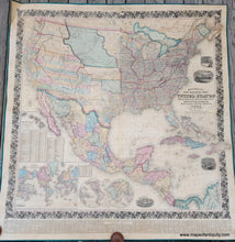
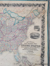
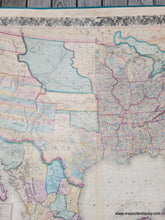
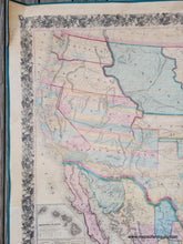
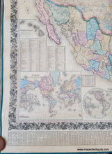
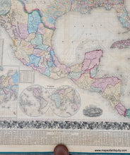
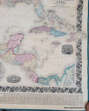
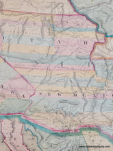
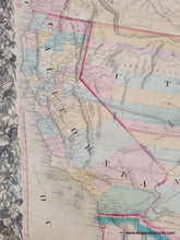
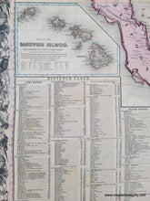
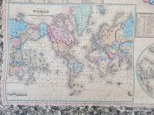
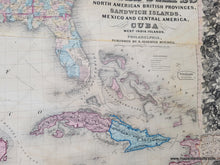
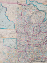
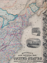
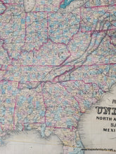
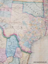
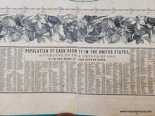
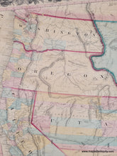
Impressive antique wall map of the United States with Mexico and parts of Canada and the Caribbean, published by Mitchell in 1858. This large, historical map captures a fascinating time in the evolution of the US, shortly before the Civil War, showing mostly territories in the West, including Oregon Territory, Washington Territory, Utah Territory, New Mexico Territory, Kansas Territory, Nebraska Territory, and Minnesota Territory. California became a state in 1850 and the next state would be Minnesota in 1858. Texas became a state in 1845 and on this map has counties in the east and a large area that had not yet been divided. The Territories of Utah and New Mexico have the interesting long horizontal counties that were later reorganized. This map also has two maps of the world- one on Mercator's projection and one on a globluar projection. There is an inset map of Hawaii, then known as the Sandwich Islands, a table of distances, several illustrations of ships including Columbus arriving in the Americas, an illustration of the Pilgrims' Landing, and at bottom a Chart of the Populations in each County per the 1850 census. This map was published several years in a row with updates, which indicates how quickly things were changing at this time. There have been examples from 1856, 1857, 1858, 1859, 1860 and 1861. This map has been restored- archivally cleaned and backed. Some minor signs of age are still visible but unobtrusive, including mild stains and repaired tears. It measures approx. 63 inches wide and 67 inches tall. Ships rolled without rods. **Note: Because this map requires additional insurance, shipping costs will be higher than average. If you would like to discuss shipping options, please contact us for customized shipping quotes.

Item Number: USA438