Genuine-Vintage-Map-A-Pictorial-Map-of-the-United-States-1944-Elmer-Jacobs---Rand-McNally-Maps-Of-Antiquity
  • Load image into Gallery viewer, Genuine-Vintage-Map-A-Pictorial-Map-of-the-United-States-1944-Elmer-Jacobs---Rand-McNally-Maps-Of-Antiquity
  • Load image into Gallery viewer, Genuine-Vintage-Map-A-Pictorial-Map-of-the-United-States-1944-Elmer-Jacobs---Rand-McNally-Maps-Of-Antiquity
  • Load image into Gallery viewer, Genuine-Vintage-Map-A-Pictorial-Map-of-the-United-States-1944-Elmer-Jacobs---Rand-McNally-Maps-Of-Antiquity
  • Load image into Gallery viewer, Genuine-Vintage-Map-A-Pictorial-Map-of-the-United-States-1944-Elmer-Jacobs---Rand-McNally-Maps-Of-Antiquity
  • Load image into Gallery viewer, Genuine-Vintage-Map-A-Pictorial-Map-of-the-United-States-1944-Elmer-Jacobs---Rand-McNally-Maps-Of-Antiquity
  • Load image into Gallery viewer, Genuine-Vintage-Map-A-Pictorial-Map-of-the-United-States-1944-Elmer-Jacobs---Rand-McNally-Maps-Of-Antiquity

1944 - A Pictorial Map of the United States - Antique Map

Regular price
$275.00
Sale price
$275.00
Regular price
Sold out
Unit price
per 
Shipping calculated at checkout.

Item number: USA451
Genuine Vintage Map

1944

Maker: Elmer Jacobs / Rand McNally

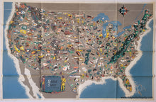
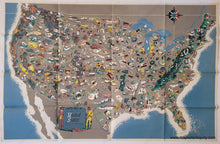
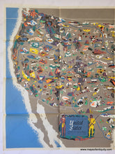
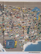
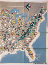
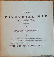
Original vintage pictorial map of the United States "painted by Elmer Jacobs & Produced by Rand McNally & Company expressly for Brown & Bigelow," c. 1944. With vibrant colors, dynamic shapes, and a graphic midcentury modern style, this map will look fantastic framed and on display. It features illustrations throughout of people, animals, buildings, famous landforms, etc. It has everything from wagon trains, pilgrims, and loggers to vacationers, Hollywood producers, and ranchers. As with many things produced in the past, this map contains some images that are not considered politically correct today. This map was issued folded into a sleeve, upon which is written "Here is visible evidence of the reasons why over one hundred thirty million Americans are proud to say... 'This is my Country.'" Very good condition with some pen marks on the back side, tiny separations at the fold intersections, and some minimal wear at the paper edges. Measures approx. 24.75 x 37.75 inches to the paper edges.

Item Number: USA451