CLOSED ON JULY 4TH! Current hours: 10am to 5pm Monday through Saturday and 12-5 on Sundays. Proud to be a SMALL, LOCAL, CAPE COD BUSINESS! Maps of Antiquity is in its 38th year! Our maps are only available at our website www.mapsofantiquity.com or at our store!

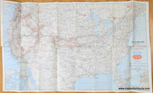
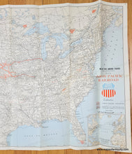
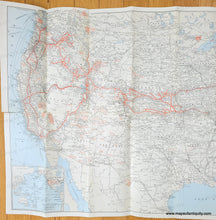
Original printed color light tan for land and blue for water with red lines for railroad and red shading for national parks. Genuine-Map-Map-of-the-United-States-Geographically-Correct-Issued-by-Union-Pacific-Railroad-1958-Union-Pacific-Railroad-Maps-Of-Antiquit
  • Load image into Gallery viewer, Original printed color light tan for land and blue for water with red lines for railroad and red shading for national parks. Genuine-Map-Map-of-the-United-States-Geographically-Correct-Issued-by-Union-Pacific-Railroad-1958-Union-Pacific-Railroad-Maps-Of-Antiquit
  • Load image into Gallery viewer, Original printed color light tan for land and blue for water with red lines for railroad and red shading for national parks. Genuine-Map-Map-of-the-United-States-Geographically-Correct-Issued-by-Union-Pacific-Railroad-1958-Union-Pacific-Railroad-Maps-Of-Antiquit
  • Load image into Gallery viewer, Original printed color light tan for land and blue for water with red lines for railroad and red shading for national parks. Genuine-Map-Map-of-the-United-States-Geographically-Correct-Issued-by-Union-Pacific-Railroad-1958-Union-Pacific-Railroad-Maps-Of-Antiquit

1958 - Map of the United States (Geographically Correct) Issued by Union Pacific Railroad - Genuine Map

Regular price
$65.00
Sale price
$65.00
Regular price
Sold out
Unit price
per 
Shipping calculated at checkout.

Item number: USA464

Genuine Map

1958

Maker: Union Pacific Railroad


Map of the United States showing the railroads in 1958. The railroads operated by Union Pacific are in red, other railroads are thinner black lines, stops and stations are indicated with a white circle, National Parks are shaded a light red. Inset maps of the Union Pacific lines across the Atlantic and Pacific Oceans. Topography is subtly indicated. Original printed color. Fair to good vintage condition with some separations along the folds, some small pin holes at paper edges. With folds as issued. Verso has information about the railroads and black and white vintage photographs that illustrate the experience. Measures approx. 18.25 x 30.5 inches to the neatline.

Genuine Map from 1958

Item Number: USA464