1873
Maker: Beers
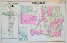
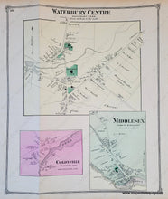
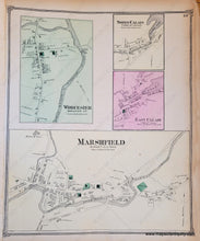
Antique map from the Atlas of Washington County, Vermont, published 1873 by F.W. Beers & Co. Double-sided page with a centerfold map of Waterbury, Vermont. On verso are small village maps of Worcester, North Calais, East Calais, Marshfield, Colbyville, and Middlesex. Colored by district and showing villages, railroads, rivers, ponds, etc. This map shows houses and other buildings with the property owners' names. Densely populated areas are enlarged in the inset map and also on verso. Good overall antique condition, with toning and some minor edge tears. Fragile paper. Waterbury map measures approximately 13.75 x 22 inches to the neatline. The smaller maps on verso measure approx. 14 x 11.5 inches to the neatline.
Item Number: VER348


