1884
Maker: Walker.
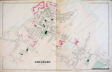
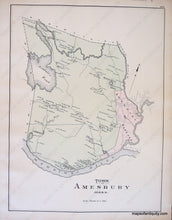
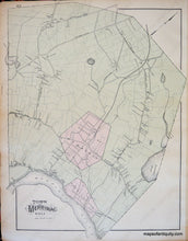
Antique hand colored maps of the Village of Amesbury, and the Towns of Amesbury and Merrimac, from Walker's 1884 Atlas of Essex County. Side one depicts Amesbury Village, including public buildings and areas, churches, the Powow River and a riverfront filled with woolen mills, roads, schools, property owners, and businesses. Side two displays the Towns of Amesbury and Merrimac, including buildings with owners' names, public buildings and areas, water bodies, landforms, islands, railroads, roads, and schools. Very good condition with light overall toning, slight darkening at center seam from the glue strip, some light image transfer, some very light minor smudging from original printing as issued. Center spread of Village of Amesbury measures approx. 16 x 25.5 inches, verso maps about half that size.
Item Number: MAS1665


